


The Georgia Traverse is an unofficial network of forest roads and rough trails that have been mapped together over the years to present a mainly off pavement trip traversing northern Georgia. It’s more of an Overlanding trip than a serious off-roading trip, but as we learned, there are still some challenges waiting for you along the journey.
Our plan was to see how much of the Traverse we could do in three days. We got a late start leaving the Charlotte region Thursday – myself in my 4Runner with my copilot Goldendoodle, and Alan in his Jeep with his Goldendoodle (yes, the dogs are brothers!), so we didn’t arrive at the Georgia border until late afternoon on the first day. We made our way down the first forest roads, and made camp at Sarah’s Creek, a remote campsite in the Chattahoochee National Forest.
We grabbed a campsite right next to the stream so the dogs could splash around some, made some dinner over the fire, and set up camp. I was camping in the back of the 4Runner on a foam mattress, Alan in a tent. We had only hit about 12 miles of road so far, and were unsure how the trip would unfold.
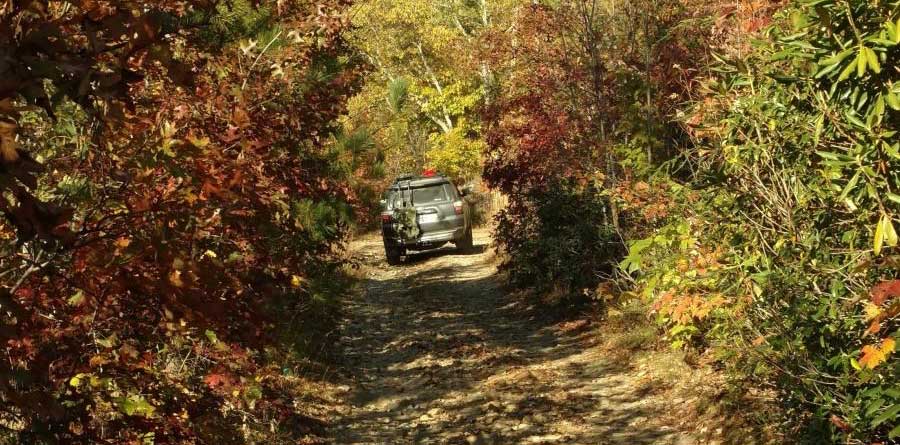
The next morning, we packed up camp and headed North on some rough, remote but still passable by car, forest roads and came out at the town of Dillon. Note that if you’re running the trip, take the chance to resupply there! We drove on through Dillon though and reentered the forest roads. After a nice climb into the mountains, and some cool creek crossings, we found our first opportunity to detour onto a tougher trail, but made it through without needing 4 low.

After about 6 hours on gravel, we reemerged onto pavement, traveled South past Lake Burton, resupplied at a small gas station, made a few side trips, and turned back onto gravel at the bottom of what was the surprise of the trip – Trey Mountain Road.

There’s this yellow caution sign at the beginning of the road. We chuckled when we saw it, thinking it was probably going to be another regular gravel forest road. Man, were we wrong.
The road immediately degraded into rough rocks and roots everywhere, which made it slow going on fully aired up tires. Then as we went further up the mountain, we started encountering water and mud holes in the road, followed by ruts that got more and more impressive the higher we climbed. After about 2 hours of climbing the trail and navigating ruts and large rocks, we hit the “interesting” section. A couple hundred feet of trail is heavily eroded, leaving large rock ledges, and a wholly exposed large culvert to cross.
At this point, it was starting to get late in the afternoon, and we were quite a ways out from where we had wanted to camp. We knew there was about 2 miles of trail left, but didn’t know if the rest of the trail was worse than what we were currently facing. We thought we could make this section, but we were concerned about hitting a worse section further up the trail we couldn’t make, and then navigating back all the way down the mountain in the dark.
We ultimately decided to go for it though, since neither of us wanted to go back down the mountain. I engaged the rear locker and ATRAC, used two foot driving to set the RPMs steady and modulated my speed with the brake. I made it up the rock ledge much easier than I had anticipated, and bounded over the culvert. Alan also ended up making it pretty easily. I think if we hadn’t have had as much experience off road, we would have easily been stuck spinning tires here for a while.

Thankfully, the rest of the trail wasn’t bad, and we made it out and to our final campsite at the Upper Chattahoochee River Campground just as night fell.
After another nice night in the forest, we woke up to a cold, wet morning. Heavy, cold rains had set in for the next two days, our camp gear was soaked, and we realized our trip was about done. The Goldendoodle was actually the first one to give in. After hopping out of the 4Runner to do his morning business, he got back in and would not leave again. He gave me the below face, which said “there’s no way I’m getting out”.

We packed up the wet camping gear, and spent another few hours again navigating the forest roads in the fog. It was a great driving experience. Making it back to the main roads, we took back roads up through Georgia into North Carolina, and passed through Highlands, Lake Toxaway, and Brevard before we finally ventured back onto interstates heading home.

At the end of the trip, we only made it through 1/3 of the Georgia Traverse’s path. We had traveled 150 miles on dirt roads, and for most of the trip were the only two vehicles on the roads. We’re already looking forward to when we can head back out and try the Traverse again, and hopefully make it much further than the first time!